Preparation
Mount Tamanos is in the SE corner of Mount Rainier National Park. The park is about a 2hr SSE drive from Seattle. Some campsites are available at Recreation.gov and for those going into the wilderness (like this Mount Tamanos hike) wilderness permits are required. I stayed in a cabin at Alta Crystal Resort which is conveniently located about 15mins drive from the ranger station at White Waters and 30mins drive to the trailhead. My cabin had full cooking facilities (restaurants are a distance away), a log fire and was clean and comfortable. AT&T provide no cellular signal and although the resort had Wi-Fi, the speed was frustratingly slow. Download any maps etc. before arrival. I used AllTrails to plan and record my hike (see below). Resources: Mount Tamanos maps. Weather Forecast. Plan your visit.
Owyhigh Lakes Trail
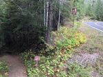
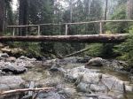
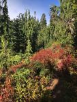
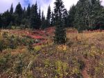
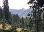
Although I had my reservation, the permit itself must be collected in person from a ranger station. Then I proceeded to the trailhead. The first 0.4miles take you downhill past some beautiful waterfalls and a couple of bridges over Deer Creek. From Deer Creek on, it is a steady uphill climb up Owyhigh Lakes Trail. The first few miles are all in forest land. Slowly the trees start to thin and the views open up. This trail is easy to follow and is well maintained. Although there was plenty of evidence of deer, elk and bear, I had no sighting. Hiking in September meant that the trees and shrubs had started to turn color and what a feast of color!
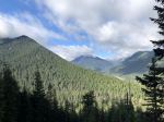
Tamanos Peak
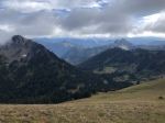
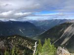
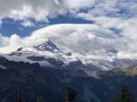
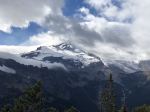
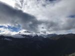
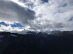
The hike from Deer Creek to Tamanos campground offers no views of Mt.Rainier. There is however, a trail leading to the Mt.Tamanos peak. This is a little hard to find. After about 5miles, there is a plateau and a sandy patch. Turn left here and start the steeper climb up an unnamed unkept trail to Tamonos Peak. If you reach Owyhigh lakes, you have gone about 0.5miles too far. At around 6232ft Mt.Rainier comes into view. After another 500ft of climbing, the peak is reached and magnificent 360degree views. All though the trail to the top is steep, it is not technical.
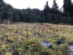
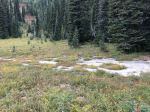
Owyhigh Lakes & Campground
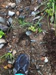
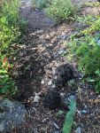
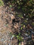
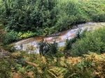
After a knee trembling climb down, I rejoined the Owyhigh Lakes trail, to the lake (where I collected water) and then the campground. The campground has a rudimentary backcountry toilet and a bear pole for lift food out of reach of the black bears. The sites are flat and have some logs to sit on. There are no views from the campground, but the trees offer some shelter from the wind. At night, the silence was deafening. In the morning, the hike down was short and fast.
The gear list for this hike is here.
Always follow the leave no trace principles.
Key Statistics
- Trail miles according to AllTrails – 14.6
- Elevation Gain according to AllTrails – 4642
Map data

Photos
WA123 Owyhigh Lakes Trail to bottom of trail to Mt.Tamanos peak.


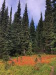


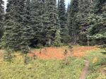


Hike up to Mt.Tamanos peak.


Views from the Mt.Tamanos Peak.


Owyhigh Lakes and Campground.


Nature on the trail.